
This is the map of Costa Rica.
Facts about Costa Rican Geography:
Deforestation and land use change, largely a result of the clearing of land for cattle ranching and agriculture; soil erosion; coastal marine pollution; fisheries protection; solid waste management; air pollution.
Cerro Chirripó is the highest point in Costa Rica. It reaches up to 12,532 ft, the fifth highest peak in Central America.
Irazú Volcano is the highest volcano in Costa Rica. It's boundaries and natural conventional and mixed, and then the San Juan River separates Costa Rica from it's northern boundaries.
Costa Rica is slightly smaller than West Virginia.
Costa Rica is the southernmost out of the five republics. It extends about 8 to 11 degrees north latitude, and between 83 and 86 degrees west longitude. Costa Rica is located on the Central American isthmus, 10° North of the equator and 84° West of the Prime Meridian It borders both the Caribbean Sea (to the east) and the North Pacific Ocean (to the west), with a total of 1,290 kilometers (802 miles) of coastline (212 kilometers / 132 miles on the Caribbean coast and 1,016 kilomoters/ 631 miles on the Pacific. It is located on the continent of North America.
Rain Forests:
The Rainforests are very humid and are home to many animals like birds, monkeys, lizards, snakes, sloths, butterflies and frogs, puma, jaguar, and Harpy Eagle. You could also see some of the rarest wildlife in the forest like Scarlet Macaws, Morpho Butterflies, Leatherback turtles and the tiny Central American squirrel monkey. They are mostly found in the Southernmost part of the Osa Peninsula.
Location Costa Rica, the southernmost of the five republics that comprise Central America extends approximately from eight to eleven degrees north latitude and between eighty-three and eighty-six degrees west longitude.
Natural Resources:
The natural resources in Costa Rica are gas, oil, and hydropower.
Water bodies in Costa Rica:
The San Juan River is 117.9 miles long. It flows east out of Lake Nicaragua. It is part of the border between Costa Rica and Nicaragua.
The Sarapiquí River, or Rio Sarapiquí is another river in Costa Rica. It is a tributary of the San Juan River
If you like the ocean, then take a tour on the coastline and you could see coral reefs. Or if you prefer, you can see a various varieties of marine animals like whales, different dolphin species, sea turtles and the endangered West Indian manatee while you're on a boat! Or maybe even on the ocean's shores.
Photo Gallery:
 |
 |
|
| Lake Nicaragua or Cocibolca or Granada is a big lake in Costa Rica. |
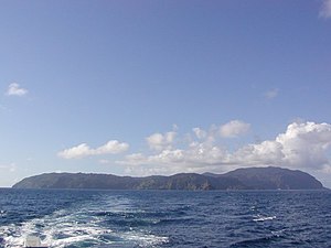
Costa Rica also comprises several islands. Cocos Isand |
Poas Volcanos are very big and erupts a lot.
|
|

|
|
|
| Rio Drake
Flows to bahia Drake in the Osa peninsula
|
La Paz Waterfall
This waterfall in on the road to the Poas volcano and can be seen from the road.
|
Manuel Antonio
One of the most visited beach in Costa Rica.
|
| |
|
|
| |
|
|
| |
|
|
| |
|
|
| |
|
|
| |
|
|
| |
|
|
| |
|
|
Cahuita
Borders the Caribbean Sea.
What do you think this is? If you guessed a volcano, you're right! It's the Rincón de la Vieja volcano.
Links: https://www.cia.gov/library/publications/the-world-factbook/geos/cs.html#Geo
http://en.wikipedia.org/wiki/Costa_Rica#Geography
http://www.costaricabureau.com/costaricainfo/costarica.htm
http://www.govisitcostarica.com/default.a
Costa Rica also comprises several islands.


Comments (0)
You don't have permission to comment on this page.